StrataSite is designed and developed in the U.S.A.
SAFETY GRANT ALERT: OHIO ATTORNEY GENERAL FY26 SCHOOL SAFETY GRANT ASSISTANCE IS NOW AVAILABLE.
OR click here to see all available grants by state.
The safety of our community depends on preparedness, collaboration, and the right tools. The StrataSite emergency preparedness program empowers first responders to act swiftly in times of crisis. By utilizing innovative solutions like StrataSite, we strengthen our ability to protect lives and keep Hancock County safe.
Sheriff Michael A. Cortez, Hancock County, Ohio
State Funding & Grants Currently Open
Explore funding opportunities and eligibility criteria by state for implementing safety and emergency preparedness initiatives for your organization.


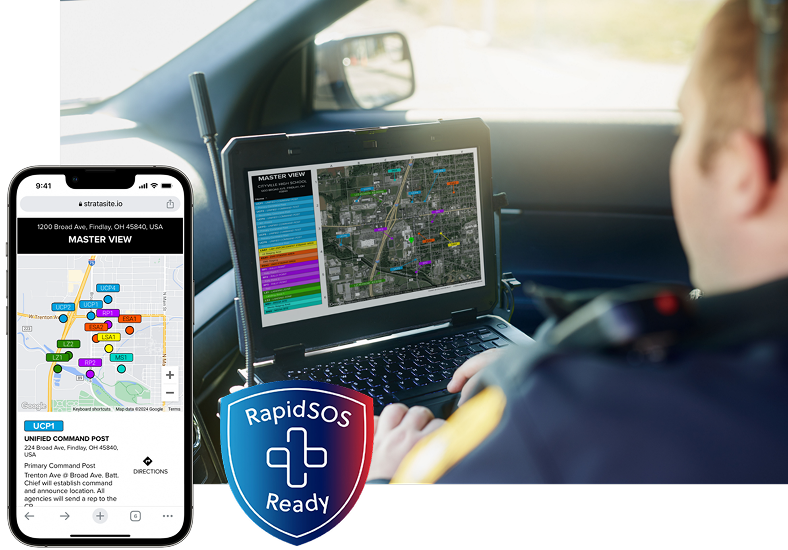
Incident Action Planning with StrataSite®
Minimize the chaos of an active threat with a unified response outside the building. Collaboratively build, share, and train around an Incident Action Plan (IAP) that includes unified command post, rally points, reunification site, air transport, perimeters, communications worksheet data, and more.
/sites/default/files/home-service-callouts/iap-pin-background-v2.jpg
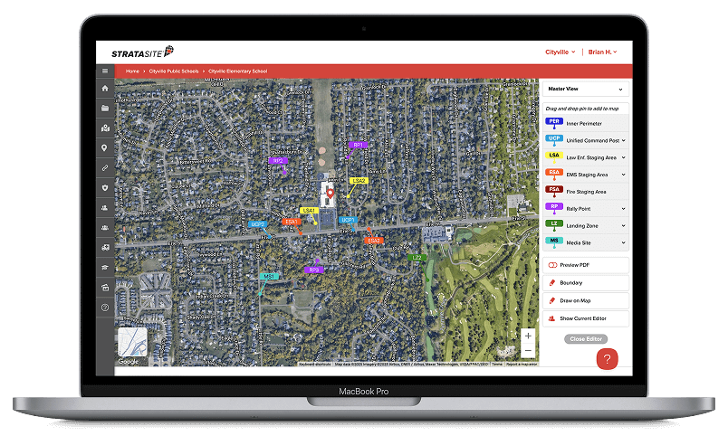
1. Build Your IAPs
Collaboratively build and share Incident Action Plans with all stakeholders on the StrataSite platform to ensure that all responders know immediately what actions are required for coordinated response.
2. Deploy IAP Information
Deploy Incident Action Plan information from StrataSite to PSAPs, mobile mass notification systems, and other widely used safety applications. StrataSite is a member of the RapidSOS® integration partner network.
Critical Incident Mapping with StrataSite®
Dynamic and scalable indoor Critical Incident Mapping that leverages the latest ESRI ArcGIS® and other technologies to empower school safety personnel and local first responders with highly precise, and actionable, location information to help save time and lives.
/sites/default/files/home-service-callouts/cim-background-v2.jpg
Emergency Operations Planning with StrataSite®
Building a school Emergency Operations Plan (EOP) with StrataSite enables collaboration and ensures a standardized, living document – simply created and optimized for ongoing readiness. Create, store, distribute, and train for increased awareness and compliance.
/sites/default/files/home-service-callouts/eop-background-v2.jpg
Article
Ohio Attorney General FY26 School Safety Grant assistance now available from StrataSite
Public & Private Organizations Trust StrataSite