Collaborate. Plan. Work Safely.
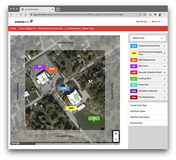 Satellite-mapping technology enables project leaders to easily pinpoint and annotate common site action points, including work areas, hazardous material zones, contamination and decontamination areas, site perimeters, rally and access points, evacuation routes, and more. Project worksheets, floor plans, and location images can also be uploaded within your site plan. Health and safety officers, project managers, site contractors, compliance officials, and networks of local first responders can simply collaborate in the development of plans.